The landscape beneath Antarctica's icy surface revealed in unprecedented detail
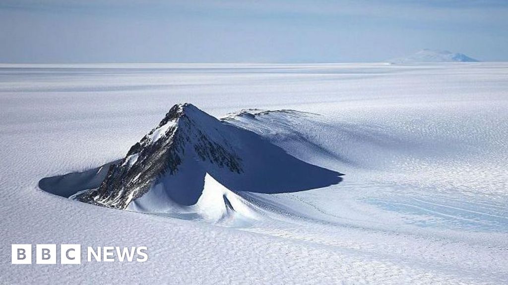
The landscape beneath Antarctica's icy surface revealed in unprecedented detail A new map has unmasked the landscape beneath Antarctica's ice in unprecedented detail, something scientists say could greatly enhance our understanding of the frozen white continent. Researchers used satellite data and the physics of how Antarctica's glaciers move to work out what the continent might look like beneath the ice. They found evidence of thousands of previously undiscovered hills and ridges, and say their maps of some of Antarctica's hidden mountain ranges are clearer than ever before. While the maps are subject to uncertainties, the researchers believe the new details could shed light on how Antarctica will respond to climate change - and what that means for sea-level rise. "It's like before you had a grainy pixel film camera, and now you've got a properly zoomed-in digital image of what's really going on," lead author Dr Helen Ockenden, a researcher at the University of Grenoble-Alpes, told BBC News. Thanks to satellites, scientists have a good understanding of Antarctica's icy surface - but what lies beneath has remained more of a mystery. In fact, more is known about the surface of some planets in our Solar System than much of Antarctica's "underbelly" - the topography beneath the ice sheet. But researchers now have what they believe to be the most complete, detailed map of that underbelly ever made. "I'm just so excited to look at that and just see the whole bed of Antarctica at once," said Prof Robert Bingham, a glaciologist at the University of Edinburgh who co-authored the study. "I think that's amazing." Traditional measurements from the ground or air have used radar to "see" beneath the ice - which is up to three miles (4.8km) thick in places - often along individual survey lines or tracks. But these tracks could be tens of kilometres apart - leaving scientists to fill in the gaps. “If you imagined the Scottish Highlands or the European Alps were covered by ice and the only way to understand their shape was the occasional flight several kilometres apart, there's no way that you would see all these sharp mountains and valleys that we know to be there,” said Bingham. So the researchers used a new approach, combining their knowledge of the ice surface from satellites and their understanding of how the ice moves from physics - and checking them against those previous tracks. “It’s a little bit like if you're kayaking in a river, and there's rocks underneath the water, sometimes there's eddies in the surface, which can tell you about the rocks under the water,” explained Ockenden. “And ice obviously flows very differently to water, but still, when the ice is flowing over a ridge or a hill in the bedrock [...] that manifests in the topography of the surface, but also in the velocity as well.” While we knew about Antarctica's major mountain ranges, the scientists' new approach has revealed tens of thousands of previously undiscovered hills and ridges, as well as...
Preview: ~500 words
Continue reading at Co
Read Full Article