Israel moves Yellow Line deeper into Gaza, satellite images show
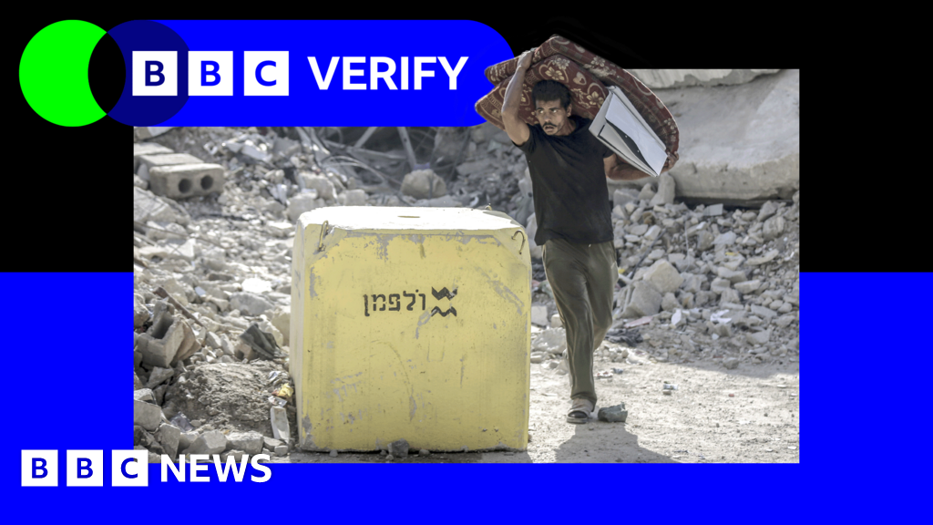
Israel moves Yellow Line deeper into Gaza, satellite images show Israel has moved the blocks which are supposed to mark its post-ceasefire line of control deeper into Gaza in several places, sowing confusion among Palestinians. Satellite images reviewed by BBC Verify show that in at least three areas Israel placed blocks, before returning later and moving the positions further into the Strip. Under the terms of the US-brokered deal with Hamas, Israel agreed to withdraw troops beyond a line marked in yellow on Israeli military maps, which it has illustrated on the ground with concrete yellow blocks. Defence Minister Israel Katz warned in October that anyone crossing the Yellow Line would be "met with fire". Since these comments were made, there have been a series of deadly incidents around the line. In Beit Lahia, Jabalia and al-Tuffah, the Israel Defense Forces (IDF) placed blocks and later returned to move them deeper inside Gaza. In total, 16 positions were moved. In the al-Tuffah neighbourhood of Gaza City, satellite images show that IDF troops moved at least seven already placed blocks between 27 November and 25 December. The position of the markers were moved on average 295m (968ft) deeper inside the Strip. As well as the blocks that have been moved, BBC Verify mapped 205 other markers. More than half of those have been placed significantly deeper inside the Strip than the line marked on maps. An IDF spokesperson said it rejected "all claims that the Yellow Line has been moved or its crossing by IDF troops". "The IDF is operating to visually mark the Yellow Line in accordance with the conditions on the ground and the ongoing operational situational assessment," they added. Analysis of satellite images up to 11 January suggests some sections of the Yellow Line - which the head of Israel's military described as a "new border line" - also remain unmarked on the ground more than three months since the ceasefire began. The latest satellite images reviewed by BBC Verify show that blocks have not been placed along roughly 10km (six miles) of territory - leaving some people in Gaza struggling to know where the beginning of what the IDF calls a "dangerous combat zone" is. Last month, one 23-year-old man near Khan Younis - whom the BBC is not naming for his own safety - said Israeli troops suddenly moved blocks near him beyond the mapped line, leaving him "trapped". "We are now living inside the Yellow Line, [but] behind the yellow blocks, with no idea what our fate will be," he said. "The atmosphere at night is terrifying. We hear shells exploding, soldiers advancing, gunfire, and drones buzzing overhead without pause. We are also being shot at directly." Prof Andreas Krieg, a Middle East security expert from King's College London, has called the movement of the blocks a "tool for territorial engineering". "By keeping the legal line on the map and the physical blocks hundreds of metres apart, Israel preserves the ability to shift where Gazans...
Preview: ~500 words
Continue reading at Co
Read Full Article