The making of Galileo
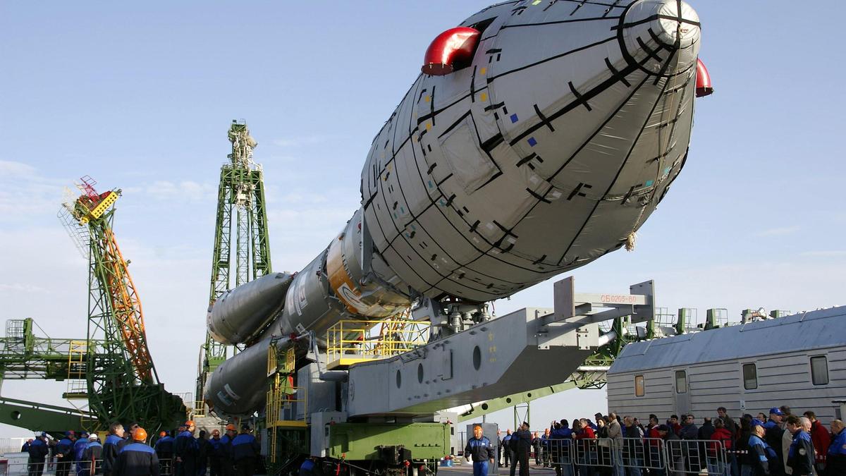
What is Galileo? A mention of Galileo, and you likely recall famed Italian astronomer and physicist Galileo Galilei. As someone who emphasised on experimentation and observation, he is often hailed as the “father of modern science”. By improving on the telescope, which was invented only during his time, he peered at the skies and made groundbreaking discoveries. He discovered Jupiter’s moons, Venus’ phases, sunspots and moon’s craters. Some of his experiments, like Galileo’s Leaning Tower of Pisa experiment, are still discussed, more than 400 years after he is believed to have performed it himself to discover that objects fell with same acceleration, regardless of their mass. But no, we are not talking about this Galileo (even though we’ve digressed right at the start quite a bit). Your next guess, probably, would be the Galileo spacecraft, named after, well, Galileo. A NASA robotic mission launched in 1989, the Galileo spacecraft studied Jupiter and its system for over a decade, becoming the first to orbit the planet and even deploying a probe into the Jovian atmosphere. Alas, we aren’t going to be discussing this spacecraft either. The Galileo we are talking about here is Europe’s own civilian-controlled Global Navigation Satellite System. What?!? Don’t we already have the GPS? Therein lies the reason why Europe wanted Galileo. When most of us talk about satellite navigation, our mind immediately jumps to GPS, or Global Positioning System. It is a form of genericisation, where a brand name actually becomes a common term for a product type. A bit like how Xerox is used for all photocopying, or Google/Googling for all online searches, or well, using Band-Aid, for any and all adhesive bandages. This might come as a shock to you in case you belong to the “most” mentioned in the previous paragraph, but GPS is not synonymous with satellite navigation. While large sections of the world use it that way, technically it is a U.S.-owned system. If GPS is just one such system, what is the broader term encapsulating all these systems, you seem to be wondering. We’ve given that to you already, actually. That term is GNSS or Global Navigation Satellite System. The two Galileo In-Orbit Validation satellites are encapsulated within their 'Upper Composite' on the vertical Soyuz ST-B launcher in this October 14, 2011 handout photo courtesy of the European Space Agency. The launch took place on October 21. | Photo Credit: REUTERS GPS enjoys this place of prominence owing to the first-mover advantage. It was the first such major system accessible to the masses, making it most recognised as well. It certainly isn’t the only such system with Russia’s GLONASS and China’s BeiDou being other systems. While India doesn’t have a GNSS, it has a navigation system called NavIC (Navigation with Indian Constellation) that is indigenous and provides accurate position, navigation, and timing services for India and a 1,500 km surrounding region. While the U.S.’ GPS, or China’s BeiDou and Russia’s GLONASS for that matter, is well and good during times of...
Preview: ~500 words
Continue reading at Thehindu
Read Full Article